+39 0131.250.313
Cerca
Loading
  • Introduzione
  • Tipi di mappe
  • Boundary and Data Files
  • Altre caratteristiche
  • Nuove caratteristiche

About MapViewer

MapViewer is an affordable mapping and spatial analysis tool that allows you to produce publication-quality thematic maps easily. Small businesses, large corporations, independent consultants, scientists, GIS analysts, and numerous government agencies are discovering important trends in their data with MapViewer. Display your data distribution easily and precisely with more easy-to-use features than ever. Your data is unique and you need the best mapping software for the job!

A thematic map visually represents the geographic distribution of your data. MapViewer will help you to:

  • understand demographics
  • define sales or insurance territories
  • outline marketing strategies
  • track population trends
  • show ecological distribution
  • display any geographically distributed data

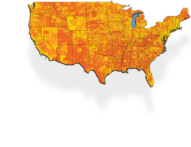
Map Types

MapViewer provides you with several map types to present your data in the most informative way possible. You can combine most map types in a single window to present several types of data in a single map.


View maps ...

MapViewer Boundary and Data Files


MapViewer supports many data and import/export formats.
The following is a list of boundary and data files included with MapViewer. These files are suitable for creating a wide variety of maps. You can download MapViewer's boundary and data files from Golden Software's web site. You can also create custom boundaries by combining existing boundaries or by using the drawing tools. MapViewer can import boundary files in several different formats so you can also use files created in other applications.
City
  • AKcity.bna - WYcity.bna: point locations of cities in latitude/longitude coordinates
  • State_Capitols_48.bna, State_Capitols_50.bna - Locations of the state capitols of the 48 contiguous United States and of all states.
  • UScity.gsb - Locations of over 500 major US cities.
  • WorldCap.gsb - Locations of over 170 world capital cities.
  • WorldCity.gsb - Locations of over 280 cities of the world.
  • WorldCity.dat: contains latitude/longitude point locations of miscellaneous world cities in Golden Software Data [.DAT] format.
DLG
  • The DLG directory contains USGS 1:2,000,000 scale DLG files converted to the Golden Software Boundary [.GSB] file format.
US County 1990
  • AK.gsb-WY.gsb: 1990 county boundary files, primary IDs are FIPS codes
  • AK.dat-WY.dat: 1990 US Census data for each county
  • US48.gsb: map of the counties of the 48 contiguous United States based on 1990 county boundaries
  • US48.dat: 1990 US Census data for the 48 contiguous United States
  • AK-HiRes.gsb-WY-HiRes.gsb: high-resolution year 1990 county boundaries
US County 2000
  • AK2000.gsb-WY2000.gsb: 2000 county boundary files, primary IDs are FIPS codes
  • AK2000.dat-WY2000.dat: 2000 US Census data for each county
  • US48.gsb: map of the 48 contiguous United States based on 2000 county boundaries
  • US48.dat: 2000 US Census data for the 48 contiguous United States
  • AK2000_HiRes.gsb-WY2000_HiRes.gsb: high-resolution year 2000 county boundaries
  • US48_HiRes.gsb: high-resolution map of the 48 contiguous United States based on 2000 county boundaries
US Miscellany
  • Climate_divisions.gsb: US climatic divisions
  • CMSA.gsb: Consolidated Metropolitan Statistical Areas for the United States
  • CMSA&MSA.gsb: Consolidated Metropolitan Statistical Areas and Metropolitan Statistical Areas for the United States
  • CD106.gsb: US Congressional districts for the 106th Congress
  • CD108.gsb: US Congressional districts for the 108th Congress
  • HI_islands.gsb: Hawaiian islands with the island names for primary IDs
  • PMSA&MSA.gsb: Primary Metropolitan Statistical Areas and Metropolitan Statistical Areas for the United States
  • US48.gsb: Contiguous 48 United States
  • US50.gsb: United States map in Unprojected Lat/Long, Alaska and Hawaii in the correct locations
  • US50.dat: 1990 Census data for each state
  • US502000.dat: 2000 Census data for each state
  • US50alb.gsb: United States map in Albers projection, Alaska and Hawaii by Southwest US
  • US50ll.gsb: United States map in Unprojected Lat/Long, Alaska and Hawaii by Southwest US
  • UScity.gsb: point location of select US cities
  • USintll.gsb: major US interstates, highways, and tollways
  • USStatePlane.gsb: US zones for the state plane projection
  • USTimeZones.gsb: time zone boundaries for the US
US PLSS
This folder contains the townships of the Public Land Survey System (PLSS). There is one file for each of the thirty states covered by the PLSS.
US Roads
This folder contains the major roads and highways of the United States. There is one file per state, plus one file of the whole United States.

World Administrative
This folder contains 1st level administrative boundaries for over 110 countries around the world. The administrative boundaries may define states, provinces, regions, or other administrative areas within a country's borders.
  • Afghanistan.gsb-Zimbabwe.gsb: administrative boundaries for various countries
World Miscellany
  • Africa.gsb:  African countries
  • Antarcal.gsb:  Antarctica Albers projection
  • Antarcll.gsb:  Antarctica Unprojected Lat/Long
  • Asia.gsb:  Asian countries
  • Camerica.gsb:  Central American countries
  • Europe.gsb:  European countries
  • Namerica.gsb:  North American countries
  • Oceania.gsb:  Australia, New Zealand, and neighboring island nations
  • Pacificn.gsb:  Pacific view of the world, negative coordinates from -360 to 0
  • Pacificp.gsb:  Pacific view of the world, positive coordinates from 0 to 360
  • Russia.gsb:  Russia boundary
  • Russia-proj.gsb:  Russia boundary split at 180 degrees
  • Samerica.gsb:  South American countries
  • World.gsb:  all countries in the world
  • World-proj.gsb:  all countries in the world, Russia and Alaska split at 180 degrees
  • World.dat:  1990 data for countries
  • Worldcap.gsb:  point locations of country capitals
ZIP3
  • AKzip3.gsb-WYzip3.gsb: three-digit ZIP code sectional centers for the United States
ZIP5
  • AKzip5-a.gsb-WYzip5-a.gsb: five-digit ZIP code area boundaries for the United States
  • AKzip5-p.gsb-WYzip5-p.gsb: US Post Office point locations for five-digit ZIP codes

Other Features

Importing Boundaries from Other Applications into MapViewer

MapViewer can import boundary information in several different vector and bitmap formats. These include:

  • Golden Software GSM, GSB, BLN, PLT, GSI
  • Atlas BNA
  • USGS DDF (SDTS), DLG, LGO, LGS
  • AutoCAD DXF
  • Windows Metafile EMF, WMF, CLP
  • Bitmap formats include TIF, BMP, TGA, PCX, GIF, DCX, JPG, PCT, WPG, PNG
  • Georeferenced bitmaps
  • ESRI SHP, E00
  • MapInfo MIF

Also, you can read coordinates from worksheet data files to place point locations on the map. Data files containing any type of coordinates can be used to indicate points.


MapViewer Worksheet

MapViewer creates thematic maps by linking worksheet data to areas or points on the map. If you need to display your own data on a map, MapViewer includes a full-featured worksheet that allows you to display, enter, edit, and save your data.

You can read data files in many formats, including XLS, SLK, WKx, CSV, TXT, DAT, MDB, DBF, DB, BNA, and BLN. In the worksheet you can transform, sort, and calculate statistics on your data.

What's New in MapViewer ?

New Map Types
MapViewer 7 introduces three new types of thematic maps - Contour Map, Non-Contiguous Cartogram, and Vector Map.
View maps ...

MapViewer System Requirements

  • Windows 2000, XP, Vista, or Windows 7 operating system
  • 80 MB of free hard disk space
  • 800 X 600 x 256 color minimum monitor resolution

Prodotti

  • MATEMATICA
  • DADISP 6.5
  • MATHCAD 15
  • SCIENTIST 3
  • proFit 6.2.5
  • Gauss 9
  • MathType 6.7
  • WebEQ 3.5
  • PUBLISHING SCIENTIFICO
  • Scientific WorkPlace 5.5
  • Scientific Word 5.5
  • Scientific Notebook 5.5
  • MuPAD Pro 4
  • TERMODINAMICA
  • Design II
  • CAD
  • DesignWorks
  • Mac Draft Pro
  • PC Draft 5
  • MacInteriors
  • LINGUAGGIO DI PROGRAMMAZIONE
  • Pro Fortran 8
  • AppForge MobileVB
  • CONTROLLO DI QUALITÀ
  • ISOPLUS9000
  • TurboQC!
  • NWA Quality Analyst
  • QcIR
  • QcUV/VIS
  • CHIMICA
  • Gaussian 09
  • GaussView 5
  • Alchemy 2000
  • ChemOffice
  • ChemDraw
  • Chem3D 8.0
  • Chem Finder 10.0
  • E-Notebook ultra 12
  • Conformer
  • HyperChem
  • KnowItAll ChemWindow Edition
  • ChemInfo
  • Q-Chem 3
  • Chemistry 4-D Draw 8
  • Nomenclator
  • NBOView 1.0
  • HSC Chemistry 7
  • Molsearch Pro
  • CIS Chemical Inventory System CISPro
  • PROJECT MANAGEMENT
  • Microsoft Project Standard 2003
  • INTERNET TOOLS
  • VersaTerm
  • VersaTilities
  • SiteKiosk 8
  • SiteCafé
  • SiteRemote
  • DESIGN
  • Photoshop CS5
  • Illustrator CS5
  • InDesign CS5.5
  • Flash Catalyst CS5.5
  • WEB DESIGN
  • Flash Professional CS6
  • Flash Builder 4.5
  • Dreamweaver CS6
  • Fireworks CS6
  • Contribute CS6
  • DIGITAL VIDEO
  • Adobe Premiere Pro CS6
  • After Effects CS6
  • Adobe Audition CS6
  • Adobe OnLocation CS6
  • Encore CS6
  • PUBLISHING
  • Bridge CS6
  • Device Central CS6
  • Media Encoder CS6
  • KIOSK
  • Kiosk Hydra
  • Kiosk Targa
  • Kiosk Wayfinder
  • MICROSOFT
  • Office 365
  • Visual Studio 2010
  • Windows 8
Iscriviti alla nostra newsletter 
Iscriviti per ricevere notifiche email
di aggiornamaneti di prodotti e la nostra newsletter,
contenente utili suggerimenti tecnici e case studies
Iscriviti

Contatti

   +39 0131.250.313
  info@net-eng.it

Termini per l'uso

Credits

Privacy